 |
| Mt. Hollyburn Summit Panorama |
Location: Cypress Provincial Park
Driving Time: 1 hr each way from metro Vancouver
Ascent Time: 1.5 hrs
Complete Time: 2.5 hours
Start Elevation:
995 m
Max Elevation:
1445 m
End of year is typically rainy and gloomy in Lower Mainland. Days are short, and opportunities for outdoor adventures are limited. Sunny days are rare, but they do happen. When skies cleared up nicely on Friday, North Shore mountains looked so inviting plastered in white -- I simply had to get out. Mt. Hollyburn seems to be tradition -- I've been up every December since I moved to Vancouver. I also knew I won't be needing snowshoes - the trail is wide and snow usually hard packed. Cypress Mountain is BC Provincial Park; getting there is quite easy. Driving west along Trans-Canada (Hwy 1) towards ferry terminal in Horseshoe Bay you take exit 8 and head up paved road to Cypress Bowl, some 15-20 minutes and 16 km from the Highway. Hollyburn trailhead is about 1 km before the end of the road to the right.

Trailhead in Cypress Bowl. The summit is visible in upper left. This is extremely popular trip year round, because of proximity to metro Vancouver. On weekends it is super busy -- elbow space is hard to find! However it is quite acceptable as short afternoon hike during the week -- even then don't expect to have the mountain to yourself!
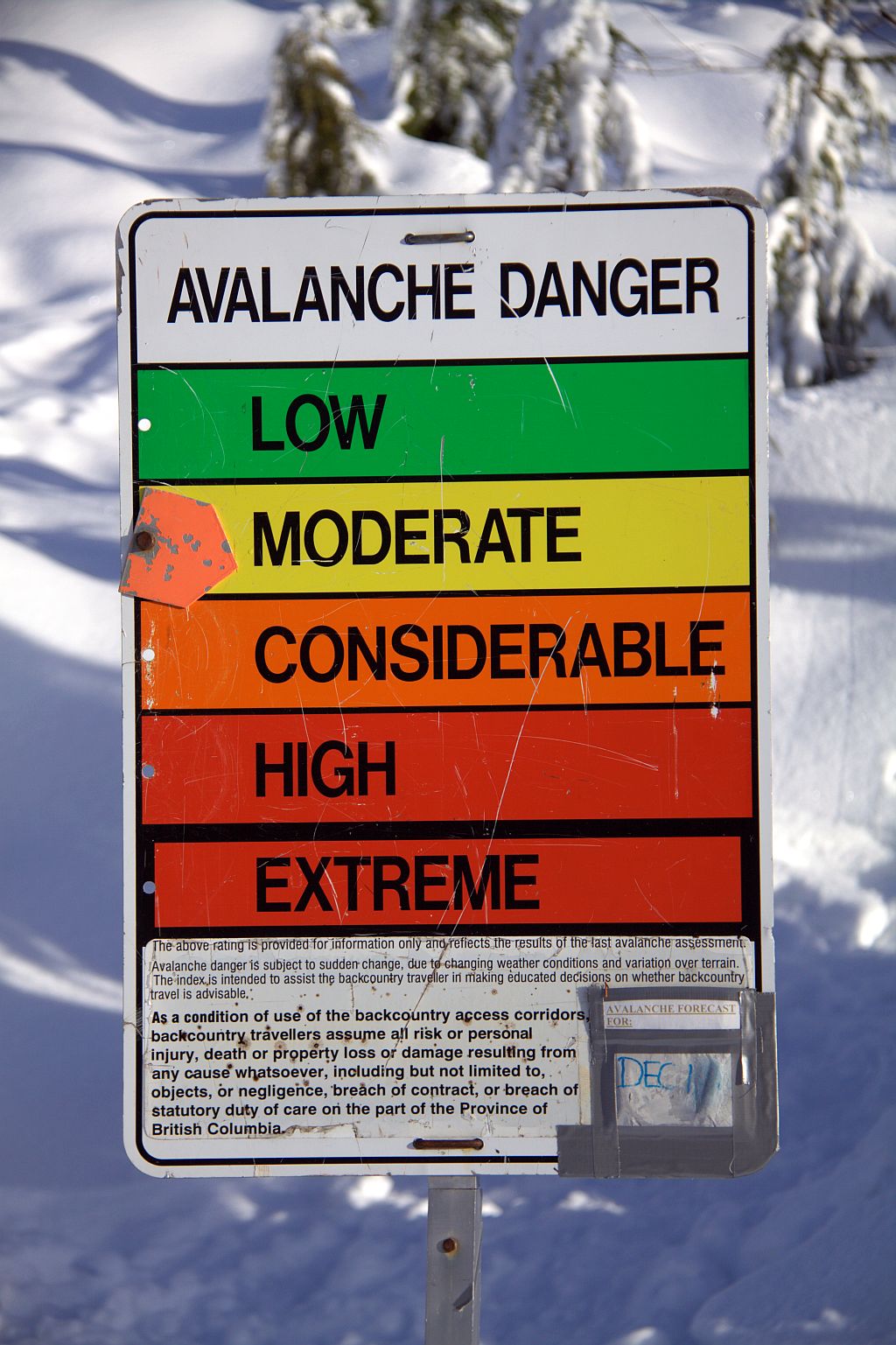
Avalanche is big issue in BC Coastal Mountains. It is hard to expect any real danger in simple tourist trail on Mt. Hollyburn, but accidents do happen in the backcountry. See this
Club Tread Post
Most of the trail is enclosed in forest, but views occasionally open up. Here we see long ridge to the east leading from Crown Mountain (right) towards Cathedral (left). I've been up Crown in October 2009 -- moderate scramble from Grouse area, but Cathedral is different story. Not desperate technically, but lots of bush and approach logistics. Usually done via Mt. Colliseum and Burwell from Lynn Headquarters area.
Baden Powell Trail Sign, buried in snow, some 40 minutes into the hike. This picture is best indicator how much snow North Shore mountains get! Baden Powell trail is about forty-eight kilometres long, extending (west to east) from Horseshoe Bay in West Vancouver to Deep Cove in the District of North Vancouver. In between, the trail winds through the heavily forested North Shore Mountains. It also connects with several other local trails. It is quite popular; more details can be seen at
BC Tourism Web Site
Final part of the Trail is a bit more steep, but not really difficult. Summit plateau at around 1440 m altitude is wide and offers 360 degrees panoramic views. Here we see Sky Pilot -- one of toughest, and most prized scrambles along Sea-to-Sky corridor. Diamond Head in Garibaldi Provincial Park to the left in the distance; remote peaks from Whistler area to the right.
View north towards East Lion from the summit. Everybody climbs (and few die as well!) climbing West Lion, but East Lion is out of reach for most people. Apparently not harder than stiff class 4, or low class 5 on
this Report


No comments:
Post a Comment